Saturday 31 October 2015

Weather guide Sunday 1st to Saturday 7th November 2015

Last weeks review: Mild and rather unsettled with some rain at times

After completing this guide last Sunday morning I regretted having taken the charts showing a high pressure ridge over England and Wales at face value as it became ominously cloudy no sooner my task was finished so I checked the webcams to see that much of West Wales was not fine and sunny as I had stated and that in fact some rogue showers were cropping up on the radar. Sometimes it is best to just look out of the window especially as a light shower arrived here at Llanwnnen just before midday - although at least the prognosis proved more reliable for the sunnier Midlands! Temperatures close to average on Sunday (Milford Haven 14.2c, Hereford 12.4c).

Just about a ground frost for the Midlands on Sunday night, too much of a breeze across WW. Mild with some sunny spells Monday although quite windy. More cloudy over Pembrokeshire with some rain at times as a slow moving front edged in. Cardigan Bay and Anglesey were very mild as the SE wind gained additional warmth descending adjacent high ground (the foehn effect). Valley on Anglesey reaching 17.7c some 5c above average (Pershore 15.3c, Shobdon 13.1c). Very mild Monday night, parts of Wales staying above 13c which is what it should be on a late October afternoon (Milford Haven 13.3c)! Sporadic rain was largely restricted to Pembrokeshire during Monday night, just the odd spot elsewhere.

Cloudy with rain on and off for much of WW Tuesday, again Pembrokeshire seeing the wettest weather (Whitechurch 17.2mm) with rainfall amounts generally quite small away from SW Wales. Most of the Midlands remained dry with some sunny intervals and was mild or very mild, as was Mid and North Wales (Gogerddan 17.3c, Coton-in-the-Elms 16.4c), while SW Wales cooled down with the rain afternoon to 11 to 13c. Patchy rain spread east across the Midlands during Tuesday night as it cleared Wales and the SW Midlands, the band then developing into heavy rain over the East Midlands on Wednesday morning. A mostly dry and bright day for Wales and the SW Midlands with the rain clearing the East Midlands early afternoon. Rather mild virtually everywhere on Wednesday (Porthmadog 16.2c, Wellesbourne 15.8c), wettest place Nottingham 21.6mm rain.

Mild last Wednesday night, a spell of rain crossed Wales and was over the Midlands by Thursday morning although it became light and patchy here. Rather a damp day then for the Midlands but soon mostly dry over WW with temperatures above average everywhere (Pershore College 15.7c, Mumbles 14.9c). Further rain during Thursday night which cleared  Friday morning to leave a largely dry and brighter afternoon. A very mild day, warm it could be described in places given it is the end of October (Shawbury 18.8c, Gogerddan 18.4c).


The week ahead: Very mild and dry to Monday with fog in places, then becoming less mild and more unsettled with some rain

Very mild last night, exceptionally so at Capel Curig where the temperature 'fell' to 14.5c. Some unusually mild weather to greet November too - a month when readings of 20c are usually out of range given the increasingly short days as Winter looms. However on Sunday and Monday this figure could be reached somewhere across southern Britain such is the warmth of the air arriving here from North Africa through this weekend and into the start of next week. As ever the places getting the highest temperatures will be those fortunate enough to experience several hours of late Autumn sunshine as there may be areas of cloud about as well as fog patches that could prove slow to clear in some places.

Dry with hazy sunny intervals this Saturday afternoon, temperatures widely reaching 16 to 18c, with 19c in a few spots, say Cardigan Bay, so very mild indeed for the last day of October. Interestingly Halloween 2014 saw record breaking warmth as London reached 23c, Pershore 22c, Trawsgoed 21c and Llanwnnen 19.4c. Clear spells Saturday night with thick fog forming in places, no lower than 6 or 7c. Any fog should clear before midday Sunday to give pleasant sunny spells for most, although a few places could be rather more cloudy or foggy for much of the day. Temperatures exceptionally mild for November reaching 16 to 19c where the sun appears for any length of time (early November average is 11 or 12c), and we may be seeing 20c touched say at Hereford or Aberystwyth! Cooler where cloudy/ foggy  at nearer 13 or 14c. Gentle SE to south breezes on Sunday. Again clear spells and calming conditions will see fog forming in some areas on Sunday night.

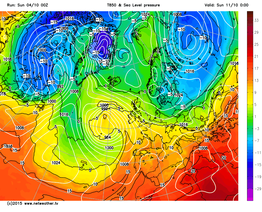
High pressure over the Continent to our east continues to feed the really mild air originating from North Africa our way on Monday too. Once any fog clears, and it may linger all morning along some river valleys, sunny spells should again occur with very mild even exceptional November temperatures likely once more as maxima attain 15 to 18c, with the odd 19c possible. Light to moderate south to SE breezes. Fog perhaps less widespread Monday night with a bit more of a breeze anticipated. We should have lost the very mild air by Tuesday with a weak front possibly affecting the west. Largely dry with variable cloud and some sunny intervals, the chance of some rain later moving north across Wales and possibly the West Midlands. Temperatures down at 13 to 15c which is though still mild for November.

The rest of the week may turn somewhat more unsettled, although amounts of rain should be small and often it will be mostly dry. Wednesday then may see a trough of low pressure move north over Wales and the Midlands with showery rain in places although some of us escape dry, still on the mild side at 12 to 15c quite light winds. Any rain should clear on Wednesday night with fog patches forming in places. Bonfire Night (Thursday) should be seeing plenty of dry and mild conditions under a ridge, although by the evening a warm front may be bringing some rain and drizzle more especially to WW. Maxima Thursday 13 to 16c.

Next Friday and Saturday we look like being influenced by a deep Atlantic depression that is set to track to the NW of the UK. This will be feeding up mild even very mild air from the SW, but there may well be plenty of cloud with winds from off the Atlantic, which could be strong at times, and so tempering the mildness. Fronts crossing the UK will bring spells of rain and drizzle from time to time, some heavy over WW with only quite small amounts expected for the Midlands. Nights could be very mild indeed in this set up falling no lower than 10 to 12c, while by day it is expected to reach 14 to 16c, with 17c possible given any brighter intervals (which may however be limited).

Sunday 25 October 2015

Weather guide Monday 26th October to Sunday 1st November 2015

Last weeks review: Mixed, some rain, temperatures around average

High pressure kept it mostly dry at first last week, Sunday was mostly cloudy, just a few light showers affecting the Midlands, temperatures close to average (Llanwnnen 14.3c, Pershore 13.6c, Capel Curig max 11.1c). All the cloud meant a mild Sunday night, staying above 11c in places (Mumbles min 11.6c). Rather cloudy and generally dry then last Monday, average to quite mild (Mumbles 16.9c, Sutton Bonington 15.0c). Another dry frost free night followed. Dry and bright Tuesday, again temperatures average to mild (Pershore 16.0c, Milford Haven 15.9c).

Appreciable rain for all for the first time in about a fortnight during Tuesday night, here at Llanwnnen a run of 12 successive completely dry days ended - the longest dry spell of 2015! Some very heavy rain in places (and contrary to the expectations for merely light rain in this guide) - 35.8mm at Gogerddan near Aberystwyth in the 24 hours to 2100 Wednesday (wettest in the UK), 11mm of this fell in the hour to 0600, many places even over the Midlands received around half an inch (e.g. Coventry 14.0mm). Wednesday and we were in mild humid westerlies with most of the rain or drizzle dying out (Hereford 18.4c, Aberdaron 15.7c).

Very mild Wednesday night, some places not below 12c (Valley min 12.6c). Somewhat cooler air arrived Thursday which was dry with sunny intervals and temps still fairly mild (Newport, Salop 16.1c, Mumbles 15.3c). Clear spells allowed a touch of ground frost for parts of the Midlands overnight. Rather cloudy and cooler with drizzle in places Friday (Valley 14.1c, Pershore College 12.8c). Some rain at times on Saturday which started mild, with early morning maxima across WW, but turned cooler but at least Wales and eventually the West Midlands dried out afternoon (Pembrey 13.8c, Pershore College 13.9c). 15.8mm rain fell at Gogerddan on Saturday compared with just 1mm at Shobdon (Herefordshire) which illustrates the 'rain shadow' effect that the Welsh hills often exert.


The coming week: Unsettled with rain at times, often mild; drier brighter intervals, especially Midlands

Quite an unsettled week to come but with timing and positioning of fronts and thus rainfall difficult to ascertain and so this guide is liable to come unstuck! Frosty Saturday night in many places but this may well be the last frost for a week or so as mild winds from between SE and SW are set to prevail. A ridge is giving a dry fine Sunday with plentiful hazy sunshine this afternoon, highs around average for the end of October at 11 to 13c. A SSE breeze picks up this evening which should prevent any frost tonight and it clouds over by morning at least across Wales. A slow moving and rather deep low to the west or SW of Ireland controls our weather through the early part of this coming week:

During Monday the fronts are for the most part over Ireland and so for most places it will be a dry day with some sunny intervals, although Pembrokeshire will be mostly cloudy with the threat of some rain from time to time being closest to the fronts. The low to our west dragging up mild air from the south, maxima between 13 and 15c, perhaps the odd 16c, a moderate to fresh SE breeze though. The rain fronts may edge a little east on Monday night which could be wet for parts of WW as a consequence, remaining dry over the Midlands, a mild night minima 8 to 11c.

Slow moving fronts strung out over Wales much of Tuesday which could well be a wet day for those parts that it gets stuck over the longest! At present the GFS model has Pembrokeshire experiencing the wettest conditions on Tuesday but this is liable to change being 48 hours away still. Some rain for all eventually though on Tuesday, even for the Midlands, although it may hold off until late in the day for Leicester and Nottingham when the front should make a more NE push. Very mild for the Midlands with the SE flow and given a few sunny intervals it could reach 17 or 18c in places here, more like 13 or 14c for wetter parts of Wales.

The rain should clear most places during Tuesday night, but much uncertainty exists over the behaviour of these rain fronts, and in any case there may be a few sharp showers over Wales in their wake. Wednesday looks like we are between the main frontal zones so a drier picture, sunny intervals but with showers in places, some of which may be heavy, temperatures reaching 12 to 14c with lighter winds. Thursday may well see further rain fronts crossing the UK bringing at least a spell of rain and fresh winds, although either side of this it should be reasonably dry, and parts of the Midlands may see little if any rain with the fronts liable to weaken as they progress east. Highs ostensibly rather mild at 12 to 14c Thursday but it may turn out quite a windy cool feeling day.

Friday and much of next weekend continues in an unsettled vein as further lows or fronts cross the UK bringing showers or longer spells of rain and potentially strong winds through from time to time, there should also be some dry bright intervals as well. There is some potential showing for a more definite prolonged wet period Friday into Saturday although some other models show fronts getting through faster with rain spells more brief. Additionally some of the models hint at an improvement by Sunday as a ridge dries things out. Temperatures Friday and over the weekend look average to mild with frost unlikely.


Sunday 18 October 2015

Weather guide Monday 19th to Sunday 25th October 2015

Last weeks review: Dry and bright West Wales with night frosts; cloudier and cooler Midlands

West Wales fared well last week, completely dry and with a fair bit of sunshine and temperatures around average, though with night frosts featuring; the Midlands however saw much more in the way of cloud with a few showers in places and was often quite cool by day but largely frost free by night.

Last Sunday was quite pleasant with some sunshine for most and quite mild for WW (Porthmadog 16.2c, Newport, Salop 14.9c). Frost and fog in places to greet Monday (Sennybridge/Tirabad min -0.7c, coldest spot in  the UK), it was then a dry day with sunny spells and temperatures near or slightly below normal (Mumbles 16.1c, Pershore 15.7c, Capel Curig 11.8c). Frost for parts of Wales and the West Midlands on Monday night, too much cloud and breeze for the East Midlands (Llanwnnen -1.0c). West Wales fared best for sunshine Tuesday (Aberporth 9.5 hrs sunniest in UK) while the Midlands clouded over afternoon, temperatures rather cool to average (Pembrey 14.7c, Astwood Bank 13.9c, Capel Curig 11.9c).

Frost for parts of Wales and the West Midlands again Tuesday night as the high continued its influence (Capel Curig -1.2c, Pershore grass min -5c), milder over the East Midlands with more cloud and breeze. Wednesday was another dry bright day for WW, but rather cloudy with a few showers for the East Midlands, temperatures again average or quite cool (Whitechurch 14.8c, Pershore College 14.3c, Capel Curig 10.9c). Much of WW remained clear with frost inland on Wednesday night (Llanwnnen -1.3c) but too much cloud and breeze over most of the Midlands and it generally stayed above 5c here (Hereford min 8.0c).

A nice day with sunny periods and fairly mild for much of WW Thursday while the Midlands was rather cool and cloudier with some showers to the SE of Birmingham (most Northants/ Oxon) (Porthmadog 15.7c, Newport, Salop 14.3c, Little Rissington max 10.2c). Ground frost restricted to inland SW Wales on Thursday night (Llanwnnen min 0.6c) with most places cloudy by morning. Plenty of cloud on Friday with a little drizzle in places, average to rather cool temps (Pembrey 14.4c, Hereford 13.0c, Capel Curig 10.8c). Another localised ground frost over inland WW Friday night, cloudy and quite mild Midlands. Saturday then generally cloudy, although bright Anglesey, average to quite cool temps and a dry day (Astwood Bank 14.1c, Valley 13.7c).

The week ahead: Often dry with some sunny spells; some rain Wednesday and next weekend

Changes in the coming week as although we are likely to become more changeable no full Autumnal Atlantic onslaught just yet (November though?) and the Midlands will be grateful to see the sun reappear! Rainfall amounts do look small this week and although most of us will receive some (chiefly during Wednesday and again next weekend) this rather dry October is not going to be greatly impacted.

Last night frost free everywhere and mild over the Midlands (many places above 9c). This Sunday afternoon is rather cloudy again but generally dry, although there could be a spot of drizzle, near average temps 12 to 15c. Mostly cloudy and frost free tonight but cloud breaks over North Wales may produce a grass frost by dawn. Still a ridge of high pressure for Monday keeps it mostly dry but rather cloudy, some sunny intervals, average temps 12 to 15c. Generally frost free overnight again. The wind shifts to the NW on Tuesday so better prospects for some mild sunshine for the Midlands, some sunny intervals for WW as well and another mostly dry day, highs 12 to 15c (best Midlands and South Wales).

Changes midweek as the high sinks south over France allowing Atlantic fronts to affect our weather at long last! A warm front may have already brought light rain and drizzle in places by dawn Wednesday, and it will be a mostly cloudy breezy day with occasional light rain or drizzle which tends to die out eventually during the afternoon. Highs mild at 13 to 16c but with a moderate to fresh WNW breeze. Mild and breezy Wednesday night with drizzle in places, no lower than 9c. The cold front clears any drizzle or rain early Thursday to give some sunny spells and a mostly dry afternoon if fresher, highs 12 to 14c with a moderate NW breeze.

There should be a ridge giving a calming dry night Thursday night with local ground frost and fog, perhaps touching 0c in colder spots. The ridge should hang on long enough to give us a pleasant dry and quite mild Friday with sunny spells, maxima 12 to 15c. Models all over the place by next weekend, best guess would be for somewhat changeable, some rain or showers about but with dry brighter spells as well, a few of us even scraping a predominantly dry weekend! Temperatures near normal (max 11 to 14c) with ground frost risk should it clear by night.


Sunday 11 October 2015

Weather guide Monday 12th to Sunday 18th October 2015

Last weeks review: Rather warm and unsettled became dry with some sun but cooler

Last Sunday was fine dry and quite mild  (Porthmadog 17.8c, Astwood Bank, nr Redditch, Worc 17.6c). The dry spell ended on Monday, many places having had 9 or 10 successive dry days, the 9 here at Llanwnnen being the second longest dry spell of the year (11 days in April). Mild and humid for the early part of the week, warm even for much of the West Midlands thanks to a few sunny intervals and the mild airmass (Monday maxima Hereford 19.9c, Trawsgoed 18.6c, Aberdaron 15.5c). Very mild nights also, coastal parts of WW remained above 13c Sunday night, while Monday night some places not falling below 14c (Shawbury min 14.9c, Mumbles 14.7c) which is about what maxima should be in early October!

17.4mm rain at Whitechurch (Pembs) in the 24 hours to 2100 Monday the wettest spot, while rain and showers amounted to over half an inch other areas too by Tuesday morning (24 hour totals Little Rissington 17.2mm, Long Lawford 15.6mm). Plenty of showers and some longer spells of rain Tuesday, but also with a few warm sunny intervals. The worst of the downpours over the Midlands and Mid Wales with thunder in a few places (Milford Haven 19.9c, Nottingham 19.4c). Church Lawford was the wettest place in the UK for the 24 hours to 1800 Tuesday with 27.0mm rain, in contrast there was just 2.8mm at Hereford.

Soggy Tuesday
Cardigan Bay and parts of North Wales were prone to streams of heavy showers merging into longer spells of rain through Tuesday evening and night, 32mm falling in the 12 hours to 0600 Wednesday at Aberporth with a PWS at Mynydd Llandegai, Snowdonia caught 2.28 inches (58mm). The low and attendant remnants of showery rain moved away east during Wednesday as we were left in a much cooler NW flow (Mumbles 15.2c, Aberporth 12.7c).

Thursday dry and bright under high pressure and rather above average temperatures generally (Pershore College 18.2c, Whitechurch 17.6c). Ground frost seems to have been restricted to Worcestershire on Wednesday night (Pershore grass min -2c) but was a little more widespread on Thursday night (Shobdon air min +1.4c). Dry again Friday, best of the sunshine over the Midlands, it was quite warm in places (Winterbourne, B'ham 18.0c, Whitechurch 17.9c, Aberdaron 14.4c). Rather cloudy but mostly dry bar a few spits Saturday and cooler with the ENE breeze (Valley 15.2c, Pershore 14.6c).

The week ahead: Mostly dry, some sunny spells, often rather cool

High pressure set to dominate this week positioned to our north or NW meaning that areas of cloud will be problematic as the cool NE flow crosses the North Sea. One of those weeks where some days could prove mostly cloudy and cool while other are pleasantly sunny, but varying from region to region, with SW Wales more favoured for brightness to prevail. Ground frosts are likely at virtually any stage this week where cloud breaks and wind drop permit.

Sunday is a pleasant day with sunny intervals and temperatures rather above average at 14 to 16c with only gentle breezes. Clear spells tonight with a ground frost over parts of the Marches and Mid Wales, 1c in places, milder and more breeze for the SE Midlands (min 7c in towns). High pressure close to Ireland Monday with a weak front moving down from the north which brings little more than cloud during the afternoon, perhaps a spot of drizzle for NW Wales though. There should be sunny intervals again Monday but cooler with the NE breeze, highs generally 12 to 14c. Clear intervals overnight and too much breeze for frost.

A large high lies across northern Britain on Tuesday which is dry with variable and perhaps extensive cloud with some sunny intervals and quite a keen NE breeze, maxima 12c or so where cloudy but up to 15c if sunny. The breeze may ease and cloud clear sufficiently to give a widespread ground frost on Tuesday night for the West Midlands and inland WW, touching 0c in a few spots. Similar for Wednesday, largely dry with sunny intervals, WW could well be quite sunny at times while the East Midlands may be rather cloudy afternoon with a spot of drizzle possible, highs 12 to 14c and only light winds. Ground frost and fog for the same prone areas overnight.

High pressure over England and Wales on Thursday, fronts moving down from the north later will weaken but cloud it over for North Wales and the North Midlands, generally thought some sunny spells are likely, highs of 12 to 14c again, close to or a little below average for mid October. This weak front could just about produce a dampening of drizzle in places during Thursday night. The next high cell is centred close to western Ireland by the end of the week so the breeze coming around from the north or NE is still rather cool. Variable cloud, best of the sun perhaps SW Wales, East Midlands more cloud prone, highs again 12 to 14c but breezy.

Still a generally dry picture even next weekend with the high remaining west of Ireland feeding down rather cool north to NE winds, which could be fresh at times. Cloud could be quite extensive and so sunny intervals more at a premium. The high could pull west enough for fronts to threaten the east, so the East Midlands at risk of some showery rain or drizzle perhaps at some stage. Feeling cool in the breeze, highs in the 11 to 15c range. With more wind and cloud frost is unlikely anywhere over the weekend. Only small amounts of rain showing even towards the end of October so it may end up quite a dry month in many areas!


Sunday 4 October 2015

Weather guide Monday 5th to Sunday 11th October 2015

Last weeks highlights: Dry and mostly quite warm and sunny; some frost and fog


The dry, sunny and rather warm spell managed to hold on for the whole week making it just about the most prolonged such spell of 2015! Last Sunday's warm spot across our regions being Whitechurch 19.4c and Coleshill 18.3c, both readings several degrees above the average for the end of September with virtually everywhere bettering 17c. Clear cool nights though at the start of last week even with ground frost over Worcestershire and the Marches Sunday night, air mins Shobdon 1.7c, Capel Curig 2.2c. Warm and sunny after the chilly start Monday (Porthmadog, Gwynedd 20.8c, Coton-the-Elms, nr Burton-upon-Trent, Derbyshire 19.6c). Similar on Tuesday although with the sun more hazy (Whitechurch 19.7c, Pershore 18.4c).

Pressure was notably high for September peaking at 1039mbar over East Midlands early in the week with the anticyclone centred over the North Sea. The high maintained its grip right through to the end of the week with more quite warm and sunny weather. Fairly sunny but breezy, quite windy even in places on Wednesday but temperatures above average again (Pembrey 18.8c, Pershore College 18.8c). On this the final day of the month Braemar in the Scottish Highlands recorded both the coldest (min -1.3c) and warmest (max 24.3c) temperatures in the whole of the UK not only for Wednesday but also for the whole of September!

Thursday was a splendid sunny day once any morning low cloud, mist or fog dispersed, temperatures warm indeed for the start of October especially for parts of WW (Mona 19.5c, Pershore College 18.6c). Fog and frost in places Thursday night (Capel Curig -1.1c), bright sunshine after any fog cleared Friday and rather warm for many places (getting above 16c qualifies for that now we are into October, Trawsgoed 18.6c, Shawbury 18.1c). Thick fog in places on Friday night, the sub 100m visibility here at Llanwnnen not being untypical and also with local frost (Swydffynnon coldest in UK min -0.4c). Any fog or cloud cleared to sunny intervals across WW while it stayed cloudy, misty and cool over much of the Midlands on Saturday (Mumbles 16.6c, Coleshill 12.2c).

Thick fog Saturday dawn

September highlights

In spite of the rather warm sunny days at the end of the month, overall September was rather cool. Although for the most part a changeable month most places were fairly dry, just a few areas getting over the average. It was prevented from being slightly dull by all the sunshine in the final week with most places ending up having a rather sunny month as a consequence! The months high temperature at Coventry was just 20.8c the lowest such figure since September 1967.

Some September rainfall totals:

Valley 44.6mm 62%
Trawscoed 70.6mm 71%
Llanwnnen 93.9mm 87%
Aberporth 51.6mm 73% 
Milford Haven 106.2mm 124%
Pembrey Sands 67.4mm 87%

Nottingham 25.4mm 42%
Coleshill 42.0mm 68%
Bablake School, Coventry 59.4mm 100%
Long Lawford, Rugby 44.5mm 82%
Church Lawford 55.6mm 85%
Hereford 31.8mm 63%

And sunshine:

Valley 187.6 hrs 143%
Llanwnnen (est) 158 hrs 127%
Aberporth 153.7 hrs 108%
Shawbury, Salop 150.2 hrs 128%
Coventry 159.5 hrs (sunniest since 2003)

The week ahead: Unsettled and mild at first, becoming mostly dry and bright if cooler

The fine spell is about to end with Sunday the last dry day (most places have a had well over a week of dry conditions). Less in the way of fog and frost this Sunday dawn (we had both briefly here at Llanwnnen), another dry day ahead with some sunshine and  quite mild at 15 to 17c. A little low arrives into the SW overnight bringing a big change to rain and strong winds to most places, some of the rain heavy, especially across Wales, no lower than 10c. Monday is a rather warm unsettled day; early rain clears  to sunny intervals and a few showers, with another rain band due later in the day. Warm humid air for Monday, temperatures generally 16 to 18c, the odd 20c possible over the Midlands where decent bright spells permit. A mild night with some shower follows, no lower than 11c.

Another low system crosses Wales during Tuesday bringing further showers and perhaps a longer spell of rain, some heavy with thunder chances. Mild and breezy highs of 15 to 17c. Showery rain lasting in places well into Tuesday night accompanied by fresh to strong NW winds for a time as the low moves away into the North Sea and bringing down cooler air. Still a few showers about for Wednesday but many places having a largely dry and bright day although cooler, maxima 12 to 14c with winds decreasing. Clear periods and quite cold Wednesday night with a widespread ground frost and fog in places by dawn.

A ridge of high pressure gives a nice dry day with sunny spells Thursday and light winds, highs average at 13 to 16c. Again frost and fog in places Thursday night as skies clear, lowest temperatures around 0c. What once was Hurricane Joaquin looks set to move towards Ireland by the end of the week, however it is prevented from bringing stormy weather to England and Wales by a blocking high over Scandinavia that should stall the deep low out to our west. Friday then looks quite a nice day again, dry for most, just the outside chance of a shower and milder at 15 to 17c.

Next weekend and ex-hurricane uncertainties aside, plenty of dry bright if breezy weather with a strong ridge into SE UK while pressure is low to our west. Still a chance that fronts do reach western UK so there is a chance of some rain and fresh winds for a time over the weekend for West Wales with the Midlands quite likely to have a completely dry weekend. Temperatures around average we shall suggest but dependent on wind direction, if there is an ESE feed off the Continent then feeling quite cool, but if it gets around more to the SSE then quite warm air would waft up (some uncertainties over this).