Headline: Cool with rain and strong winds Monday/ Tuesday; then mostly dry becoming very warm, perhaps even hot briefly; thunderstorms in places Friday/ Saturday; turns cooler weekend
Last week's highlights
Last Sunday turned out surprisingly warm over Herefordshire, presumably due to sunny intervals ahead of the weak front that was giving cloud and a little rain over some other parts of the Midlands?Hereford itself managed 20.6c, but with most of the Midlands under cloud and maxima more like 17c; it a rather cool day over Cardigan Bay and North Wales behind the front, max just 12.7c Aberporth inspite of afternoon sunshine. Bank Holiday Monday was at least largely dry, if rather cool again as well as quite cloudy, temperatures for most reaching between 13 and 16c (high max Pershore 17.1c, Pembrey 16.6c, low max Aberporth 12.0c). It turned fairly sunny for all areas during Tuesday afternoon and generally a touch warmer (Hereford 18.8c, Pembrey 16.3c) although some areas still on the cool side (as at Aberporth 12.9c and Shawbury 14.6c).
Clear spells led to a widespread grass frost Tuesday night - the latest at Coventry since the one on 29th June 2011 (min Tirabad, Powys 1.5c, Llanwnnen 1.7c, Pershore 2.1c). Pleasant sunny spells for a while on Wednesday but some rain arrived across WW eventually afternoon (max Hereford 18.7c, Llanwnnen 16.7c). These fronts failed though to bring significant rain during Wednesday or the overnight period away from Snowdonia, and following them very few showers about on Thursday, many places dry and bright if rather cool and breezy (max Capel Curig 11.9c, Pershore 17.0c).
A spell of heavy rain for many early on Friday (although barely a drop at Little Rissington) cleared to a few showers and sunny spells, but a cool and breezy day (max Pershore 15c, Capel Curig 11.2c, wettest Swyddfynnon, Ceredigion 18mm, Pershore 10mm). Some pleasant sunny spells Saturday as a ridge gave a dry day, however for most quite cool yet again, especially along coasts (max Hereford 16.5c, Llanwnnen 16.1c, Aberdaron 11.2c) . Some rain did reach WW during the evening with some, though not large amounts everywhere last night as well.
(Note: warmest/ coldest/ wettest quoted places may be for both West Wales and Midlands or combined regions)
The week ahead
A disturbed start to the coming week as a deep low crosses Scotland bringing wet and wild weather from Monday pm lasting into Tuesday, then convincing signs in the models that there will be a short-lived very warm or even hot spell by the end of the week!
Bits and pieces of rain mostly cleared during this Sunday morning to leave sunny intervals and the odd shower this afternoon, quite cool again, highs 13 to 15c with the WNW breeze. Becoming mostly dry with clear spells tonight with the 3 to 6c minima cool enough for very localised ground frost even if it is June 1st! A bright dawn to Monday flatters to deceive as the cloud thickens and wind strengthens through the morning with rain moving into WW by lunchtime. A wet and windy afternoon for most, the SW wind gusting to at least gale force inland and as high as 70mph for exposed coasts and hills, so with trees in full leaf there could be some travel problems. Particularly wet on Monday across Wales where an inch or more may fall in many areas, although most of the rain quite light for the Midlands. Maxima ranging from 15c over brighter East Midlands, to a very poor 11 or 12c for West Wales (WW), so a truly awful start to Summer here = very cool, very windy and wet!
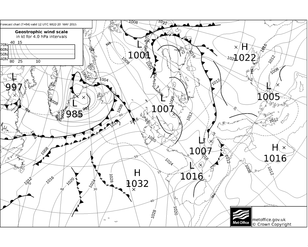
During Monday night the deep low with a central pressure around 980mbar is crossing Scotland, further rain at times as a warm sector comes through which may raise temperatures after midnight to above 12c for most areas, some of the rain still heavy at times for Wales in particular, so that by Tuesday morning some spots may have had 50mm (2 inches) in the 24 hours. The rain should finally be clearing the Midlands by early Tuesday afternoon to leave sunny intervals and a few scattered showers and with the wind decreasing. Highs afternoon between 14 and 18c, best for the Midlands and South Wales. Becoming largely dry overnight with improvements for Wednesday as pressure builds over southern UK, a mostly dry day, bar the odd light shower for North Wales and the North Midlands, sunny intervals and maxima between 15 and 19c (coolest for western coasts due to onshore breezes). Clear spells and cool for Wednesday night down to 5c in places.
High pressure likely to be centred to our east on Thursday which sees warm air advecting our way from off the Continent. A nice dry, warm and quite sunny day then at last, maxima between 20 and 23c, but cooler sea breezes for some coasts. Uncertainties with developments from Friday into the weekend but we should experience a very warm, even quite hot day on Friday but with thunderstorms in places. The latest GFS run supporting this evolution with highs widely of 24 to 27c (81f). The model consensus does seem that this will be a hot blip however and as soon as Saturday we see things cool down! At some stage in the day a cold front is likely to progress east, this perhaps setting off further thundery downpours across the Midlands, with scattered lighter showers for Wales. Wales likely to see maxima back down to just 16c, with 20c perhaps the best for the Midlands but this a long way off and it is not out of the question that the heat hangs on for one more day here? Sunday and a new but most likely cool high is closeby so it should be pleasant enough with sunny spells and temperatures reaching say 16 to 20c. Looking further out into the middle of June, plenty of generally dry and bright weather showing up although with temperatures only around average for June ( 17 to 20c).


Last week's highlights
Last Sunday turned out surprisingly warm over Herefordshire, presumably due to sunny intervals ahead of the weak front that was giving cloud and a little rain over some other parts of the Midlands?Hereford itself managed 20.6c, but with most of the Midlands under cloud and maxima more like 17c; it a rather cool day over Cardigan Bay and North Wales behind the front, max just 12.7c Aberporth inspite of afternoon sunshine. Bank Holiday Monday was at least largely dry, if rather cool again as well as quite cloudy, temperatures for most reaching between 13 and 16c (high max Pershore 17.1c, Pembrey 16.6c, low max Aberporth 12.0c). It turned fairly sunny for all areas during Tuesday afternoon and generally a touch warmer (Hereford 18.8c, Pembrey 16.3c) although some areas still on the cool side (as at Aberporth 12.9c and Shawbury 14.6c).
Clear spells led to a widespread grass frost Tuesday night - the latest at Coventry since the one on 29th June 2011 (min Tirabad, Powys 1.5c, Llanwnnen 1.7c, Pershore 2.1c). Pleasant sunny spells for a while on Wednesday but some rain arrived across WW eventually afternoon (max Hereford 18.7c, Llanwnnen 16.7c). These fronts failed though to bring significant rain during Wednesday or the overnight period away from Snowdonia, and following them very few showers about on Thursday, many places dry and bright if rather cool and breezy (max Capel Curig 11.9c, Pershore 17.0c).
A spell of heavy rain for many early on Friday (although barely a drop at Little Rissington) cleared to a few showers and sunny spells, but a cool and breezy day (max Pershore 15c, Capel Curig 11.2c, wettest Swyddfynnon, Ceredigion 18mm, Pershore 10mm). Some pleasant sunny spells Saturday as a ridge gave a dry day, however for most quite cool yet again, especially along coasts (max Hereford 16.5c, Llanwnnen 16.1c, Aberdaron 11.2c) . Some rain did reach WW during the evening with some, though not large amounts everywhere last night as well.
(Note: warmest/ coldest/ wettest quoted places may be for both West Wales and Midlands or combined regions)
The week ahead
A disturbed start to the coming week as a deep low crosses Scotland bringing wet and wild weather from Monday pm lasting into Tuesday, then convincing signs in the models that there will be a short-lived very warm or even hot spell by the end of the week!
Bits and pieces of rain mostly cleared during this Sunday morning to leave sunny intervals and the odd shower this afternoon, quite cool again, highs 13 to 15c with the WNW breeze. Becoming mostly dry with clear spells tonight with the 3 to 6c minima cool enough for very localised ground frost even if it is June 1st! A bright dawn to Monday flatters to deceive as the cloud thickens and wind strengthens through the morning with rain moving into WW by lunchtime. A wet and windy afternoon for most, the SW wind gusting to at least gale force inland and as high as 70mph for exposed coasts and hills, so with trees in full leaf there could be some travel problems. Particularly wet on Monday across Wales where an inch or more may fall in many areas, although most of the rain quite light for the Midlands. Maxima ranging from 15c over brighter East Midlands, to a very poor 11 or 12c for West Wales (WW), so a truly awful start to Summer here = very cool, very windy and wet!
During Monday night the deep low with a central pressure around 980mbar is crossing Scotland, further rain at times as a warm sector comes through which may raise temperatures after midnight to above 12c for most areas, some of the rain still heavy at times for Wales in particular, so that by Tuesday morning some spots may have had 50mm (2 inches) in the 24 hours. The rain should finally be clearing the Midlands by early Tuesday afternoon to leave sunny intervals and a few scattered showers and with the wind decreasing. Highs afternoon between 14 and 18c, best for the Midlands and South Wales. Becoming largely dry overnight with improvements for Wednesday as pressure builds over southern UK, a mostly dry day, bar the odd light shower for North Wales and the North Midlands, sunny intervals and maxima between 15 and 19c (coolest for western coasts due to onshore breezes). Clear spells and cool for Wednesday night down to 5c in places.
High pressure likely to be centred to our east on Thursday which sees warm air advecting our way from off the Continent. A nice dry, warm and quite sunny day then at last, maxima between 20 and 23c, but cooler sea breezes for some coasts. Uncertainties with developments from Friday into the weekend but we should experience a very warm, even quite hot day on Friday but with thunderstorms in places. The latest GFS run supporting this evolution with highs widely of 24 to 27c (81f). The model consensus does seem that this will be a hot blip however and as soon as Saturday we see things cool down! At some stage in the day a cold front is likely to progress east, this perhaps setting off further thundery downpours across the Midlands, with scattered lighter showers for Wales. Wales likely to see maxima back down to just 16c, with 20c perhaps the best for the Midlands but this a long way off and it is not out of the question that the heat hangs on for one more day here? Sunday and a new but most likely cool high is closeby so it should be pleasant enough with sunny spells and temperatures reaching say 16 to 20c. Looking further out into the middle of June, plenty of generally dry and bright weather showing up although with temperatures only around average for June ( 17 to 20c).