Saturday 29 August 2015

Weather guide Sunday August 30th to Sunday 6th September 2015

Last weeks review:  Showery and rather cool

Wet last Sunday across much of Wales, thunderstorms during the morning over Herefordshire, with some rain in the afternoon for the rest of the Midlands (Hereford 40mm in the 24 hours to midday). Warm for the Midlands before the rain  arrived, a very cool day for WW (Sutton Bonington, Notts 27.0c, Aberdaron max 14.0c). Cool and cloudy with rain at times for much of the Midlands on Monday, most of WW was dry with sunny intervals but temperatures still on the cool side (Porthmadog 19.3c, Nottingham 18.4c, Little Rissington 14.8c). It became clear and cool Monday night (Llanwnnen 4.8c, Shobdon 7.2c) parts of the Midlands not so cool though (Church Lawford 10.6c) nor along the south coast (Mumbles min 13.1c). After a dry start rain at times in most places during Tuesday which was a cool day (Pershore 18.7c, Aberystwyth 18.2c, Aberdaron 15.6c). Much of the rain quite light with very little over parts of the Midlands while some of the rain over Wales was heavy.

Rain and squally winds Tuesday night into Wednesday morning, heaviest over South Wales (Mumbles 25.4mm, exactly 1 inch) with gusts to 50mph over some exposed parts of Wales such as Pembrey Sands.  Sunny intervals and some showers followed but many places missed most of these these and had a dry bright afternoon, temperatures near or a little below average (Pershore 21.9c, Trawsgoed 19.5c, Capel Curig 16.4c). A breezy Thursday saw sunny intervals and showers, some of these being heavy with a rumble of thunder in places, while some places stayed dry and fairly sunny (Mumbles 8mm, Shawbury 0mm/ 10 hrs sun). Temperatures rather below average (Nottingham 19.8c, Llanwnnen 18.3c, Aberdaron 16.0c).

Sun and showers Friday as well, some heavy ones over Wales, but few affecting the Midlands and quite a few places stayed dry and bright here (Wellesbourne 10 hours sun), as did some coastal parts of Wales. A breezy day with temperatures near or below average (Hereford 20.6c, Mumbles 18.9c, Capel Curig). A scattering of showers also during today (Saturday) these fewer and farther between once more though and much of the Midlands is having a dry, bright afternoon with temperatures well up to the late August average (21c Midlands, 19c WW).

The week ahead: Cool; showery to midweek  becoming mostly dry with sunny intervals

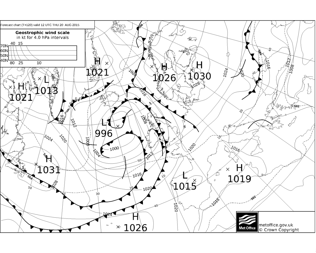
A plume of warm air attempts but fails to extend north on Sunday, instead the warm front is set to give rain in places Sunday into Monday, more especially for the Midlands. It looks as though the rain will be patchy at worst on Sunday and largely restricted to the Midlands with WW having a largely dry day, sunny intervals in many places too. Temperatures in the 17 to 20c bracket Sunday close to average. Hard to say as this front is giving the models a headache, but the rain may become more organised during Sunday night and affect both Wales and the Midlands, so some heavy rain in places during the night, no lower than 10c away from NW Wales which should stay dry with clear intervals.

Rain perhaps lingering into Monday morning across the Midlands but should be turning showery, with then a sunny intervals and showers afternoon for most places, parts of Wales staying dry, highs generally 17 or 18c but just 15c for the East Midlands if the cloud and  rain sticks. Any showers tending to die out during Monday night with clear spells. Tuesday and Wednesday we are between high pressure over the Atlantic and a deep low over Scandinavia, a cool rather showery north to NE airstream with sunny intervals, some places and more especially South Wales, escaping the worst of the showers, but some heavy showers over the Midlands in the afternoons perhaps with thunder very locally, highs between 15 and 18c for most parts.

Subtle changes from Thursday as the high may edge closer to Ireland and intensify winds turning more definitely NE. What does this mean for our weather? Well, it stays cool, WW most favoured for any sunny spells, whilst then East Midlands is most likely to still be getting some showers at times, highs 15 to 18c. Should skies clear sufficiently and given light enough winds by night then there will be ground frost in some rural spots minima as low 2c in the air. High pressure looks like staying to our west even into next weekend, which therefore continues on the cool side (north to NE breeze), often dry with sunny intervals, Pembrokeshire favoured best for higher amounts of sunshine, with any sacttered showers tending to be over the Midlands, highs 15 to 18c, perhaps a 20c for SW Wales.

Sunday 23 August 2015

Weather guide Monday 24th to Bank Holiday Monday 31st August 2015

Last weeks review: Another mixed bag; rather warm and dry parts of the Midlands

Dry with some sunny intervals last Sunday, temperatures close to or somewhat below normal (Church Lawford 21.2c, Llanwnnen 19.9c).  Sunny intervals and feeling pleasantly warm Monday and dry again (Llanwnnen 21.7c, Church Lawford 21.5c), Welsh coasts being quite sunny (Valley 13.3 hours).   Further cool Summer nights early last week though, (Capel Curig min 3.5c Monday night), with an almost unprecedented run of very cool August nights here at Llanwnnen, minima 15th - 18th: 6.2c, 2.4c, 4.3c, 3.8c. Contrasting fortunes on Tuesday, a lovely rather warm and sunny day for much of Wales, quite nice for Shropshire and Herefordshire too with some sun,  however a rain front over Eastern England (last weeks guide expected this rain to stick close to the east coast) made it disappointingly cloudy over the Midlands with some light rain getting far west as Leicester and Derby (Hereford 23.1c, Llanwnnen 20.3c).

Mostly cloudy with rain and drizzle for WW on Wednesday, some of this very heavy in places (Pembrey Sands 25.8mm).  After some early sunshine some light rain for much of the Midlands eventually during the afternoon or evening. A cool day with all the cloud and rain across Wales and the West Midlands, only the East Midlands getting close to average (Nottingham 21.0c, Aberystwyth 18.2c, Aberdaron 16.0c). Humid and rather cloudy with light rain or drizzle in places Thursday (Pershore 23.2c, Trawsgoed 22.1c), and warm on Thursday night nowhere below 15c (Nottingham min 17.6c).  More in the way of rain and drizzle across Wales on Friday, some quite heavy over the hills (Capel Curig 18mm), the Midlands stayed largely dry but with a lot of cloud. Another humid day and quite warm over the Midlands where it brightened (Church Lawford 22.8c) and also around Aberystwyth (Trawsgoed 21.7c).

Rain for a time on Saturday across WW, while the Midlands was in a plume of very warm SE winds. The sun appeared over much of WW eventually and it ended up quite warm and humid in places (Llanwnnen 22.4c), but remained cool and damp further west (Aberdaron 15.5c), while much of the Midlands was hot and sticky (Wellesbourne 29.3c), Thunderstorms broke out over the North and West Midlands in particular during the late afternoon and evening these quite severe in places especially Shropshire and Herefordshire (Shobdon 21mm).  A wet Saturday night and Sunday morning for much of WW (Milford Haven 36mm in the 24 hours to 0600), in contrast little if any rain so far this weekend for parts of the Central and East Midlands (Church Lawford 0.8mm same 24 hr period).

The week ahead: Unsettled and rather cool, several wet days; perhaps drier and warmer next weekend

Rain lingering over North Wales on Sunday afternoon, but for much of Wales it becomes mostly dry with sunny intervals. There have been futher thunderstorms over the Welsh Marches this Sunday morning, this band of rain and in places thunderstorms be progressing NE during the afternoon to the rest of the Midlands. Highs Sunday varying from a very cool 15c for wet NW Wales to a warm 26c for Nottinghamshire. Rain clears North Midlands before midnight to leave a largely dry and cooler, fresher night than of late, mins 9 to 12c. Another low is set to cross SE England during Monday and will bring wet weather into the Midlands in particular. A wet day seems likely then for most of the Midlands, potentially an inch for some spots, some rain or showers affecting Wales too on Monday, but some areas here escaping with a dry day. A cool or very cool day, probably no higher than 18c anywhere, and for the wetter areas just 15c. The rain clears to leave another mostly dry and cool night.

Tuesday may start dry and bright but more fronts will be moving NE bringing further rain, this heavy in places. Another mostly cloudy and cool day too, maxima 16 to 19c, with a fresh SW wind. It may dry up later in the day across SW Wales and more generally during Tuesday evening and early night. However, yet another pulse of wet and quite windy weather may be coming through during the night into Wednesday morning, with this rain perhaps lingering well into the day over the Midlands, but should turn to sun and showers across Wales. Showers and a possible longer spells of rain and quite windy at times sums up Thursday as deep areas of low pressure track to our NW, some spots may escape though with a not so bad a day.

Low pressure influence eases somewhat by the end of the week so hopes that it becomes rather drier, brighter and warmer, there are still likely to be showers in places however on both Friday and Saturday, temperatures improved then at max 19 to 22c, and close to average for the end of August. Signals do not suggest a lot of rain for next Sunday nor the Bank Holiday Monday either, however some of the models are showing another troublesome low arriving from the south that would bring further cool and wet weather similar to what will be the case tomorrow, this would spoil the Bank Holiday but seems one of the less likely scenarios, best bet would be for sunny intervals and a few showers and near average temperatures.


Tuesday 11 August 2015

Weather guide Monday 17th to Sunday 23rd August 2015

Last weeks review: Often dry and sometimes warm  but very cool and in places wet Friday

Warm with sunny intervals for the Midlands last Sunday while rather cloudy with a little drizzle for West Wales (WW), temperatures quite warm over parts of the Midlands but generally near or below average (Nottingham 23.9c, Trawsgoed 20.6c, Capel Curig 16.0c). Sunday night was very mild, not dropping below 14c for most (Pershore min 17.1c), some showery rain in places for a time Monday but some stayed dry and it brighened during the afternoon. Temperatures by day near or below average for WW (Llanwnnen 20.6c, Aberdaron 16.4c) while the Midlands turned rather warm with the late sunshine (Coleshill 24.1c). Mist and cloud cleared most places Tuesday to a give pleasant dry day with some sunny spells and near average temperatures (Newport, Salop 22.7c, Milford Haven 20.1c). Aberporth although the sunniest spot in the UK on Tuesday with 10 hours bright sunshine was also the coolest spot in Wales with a max of just 16.4c due to the breeze off a cool Cardigan Bay.

Mostly clear and cool inland Tuesday night (Capel Curig 3.7c) although much milder around coasts (Mumbles min 14.0c). Warm and mostly sunny Wednesday, the warmest day of August thus far for parts of Wales (Llanwnnen 24.4c, Trawsgoed 23.7c) with some slightly higher readings over the Midlands (Coton-in-the-Elms, near Burton-on-Trent, Derbyshire 25.8c) although again much cooler for some Cardigan Bay coasts (Aberporth 18.3c). Big temperature contrasts across Wales during Wednesday night, over the inland north where it was clear it turned very cool (Capel Curig 6.3c), very mild for parts of the south coast on the other hand with more cloud plus a warmer air mass advecting up from France (Mumbles min 17.1c). A lot of cloud on Thursday, with some rain or showers eventually, much of this light and patchy, but with increasingly heavy showers over the East Midlands during the evening. It was briefly warm during morning sunshine here at Llanwnnen (23.1c) and for NW Wales where the sun shone longest (Porthmadog 23.3c), otherwise temperatures average at best (Wellesbourne 20.7c).

Rain became widespread and particularly heavy at times across the Midlands Thursday night into Friday: 27.2mm fell in under 12 hours at Long Lawford (Warks) to 0900 Friday, with 15mm falling in just 1 hour at nearby Church Lawford, even wetter at Pershore (Worc) - a 44mm deluge in the 24 hours to 1800 Friday. It was also a very mild night at above 14c for most places, contrastingly though Friday was cool and cloudy as the air mass changed, many places barely warmer in the afternoon than they had been the previous night (best Porthmadog 18.3c, worst Swyddfynnon max 14.9c) The rain and drizzle cleared WW in the afternoon but persisted into the evening over parts of the Midlands although much lighter by this stage, a few late bright intervals then across WW. Bright but rather cool and mostly dry Saturday (Pershore 20.0c, Milford Haven 17.8c, Aberporth & Capel Curig 15.4c). Very cool for August last night with a ground frost in Shropshire (lowest air min Llanwnnen & Shobdon 2.4c).


The week ahead: Mostly dry and reasonably warm start, more unsettled from Wednesday/ Thursday with some rain or showers

Mostly dry with some sunshine the rest of Sunday afternoon, a few places catching a shower though, disappointing Summer temperatures once more, nowhere likely to better 20c but at least winds are light and so it will be quite pleasant in any sunny intervals. Dry and cool with clear periods tonight, locally 3c in rural spots with some dawn mist or fog. This same slack 'No Man's Land' set up remains until midweek with a mostly dry and quiet spell of weather through perhaps to at least Tuesday and possibly also Wednesday, some pleasant sunny spells and just  the outside chance of a shower. Chilly over Wales in particular Monday night, 5c in places here but a bit milder over the Midlands. Getting a bit warmer in the first part of the week and by Tuesday many places inland should be into the low 70's f (21 to 23c) with winds remaining generally light although cooling sea breezes may well set up for coastal Wales making it more like max 18 or 19c here.

Slow moving area of low pressure to the NW of the UK are taking command of our weather from Wednesday. Enough of an influence of high pressure close to SE UK on Wednesday itself to provide a dry and warm day over the Midlands where some spots may reach 25c given decent sunny spells. It seems likely though that rain fronts will be arriving across Wales during the course of the day with freshening southerly winds and so perhaps not such a pleasant day here as it may end up rather wet and windy, and if so no higher than 18c. Still a chance does exist that these fronts are delayed and WW also gets at least a half decent Wednesday. There could well be rain at times during Wednesday night with the Midlands still in with a chance of staying mostly dry. The progress of fronts across the UK difficult to assess on Thursday too, it does look like Wales at least will be seeing further showery rain at times, although there should also be drier spells, the Midlands also has a rain risk but a better chance of staying dry in places. Temperatures cloud/ rain dependent on Thursday, 24c potentially over the brighter East Midlands, with WW unlikely to see better than 20c and cooler still if wet.

Friday and the weekend the air mass looks set to turn more definitely unsettled and cooler for all areas. Probably a sunny intervals and showers set up, so some places escaping these and not having so bad a weekend, but some longer spells of rain cannot be ruled out either. It must be stressed however that that there is no clear signal for next weekend and so this prognosis may prove somewhat inaccurate - mixed Summer 2015 continues!


Sunday 9 August 2015

Weather guide Monday 10th to Sunday 16th August 2015

Last weeks review: Changeable with some rain at times; cool to average temperatures

Warm last Sunday after the prolonged cool spell with most places above 20c (Wellesbourne, Warks 25.8c, Pembrey Sands 22.5c), there were a few showers about but most places were dry with some sunshine. In contrast to the cool late July nights Sunday night was nice and warm, no lower than 16c in places (Trawsgoed 16.5c), there was a little rain in places, mostly for parts of Wales (Milford Haven 3mm). Further small amounts of showery rain across Wales on Monday, with much of the Midlands having another largely dry, bright and quite warm day, it was cooler out west though (Church Lawford 23.2c, Llanwnnen 19.0c). Tuesday was cool, windy and showery across much of Wales (Valley 18.1c, Llanwnnen 15.6c) only a few showers surviving across the hills to the Midlands, some pleasant sunny intervals here raising temperatures closer to the average in places (Coleshill 20.8c). Winds reached 50mph for some exposed parts of Wales such as Capel Curig which (not unusually) was also the coolest and wettest place on Tuesday (max 14.2c, 14mm).

Mostly dry and bright for a time on Wednesday, showers and some longer spells of rain arrived eventually afternoon or evening to much of Wales, with some also to parts of the Midlands although many places here escaped dry. Temperatures near or a little below average (Wellesbourne 21.6c, Trawsgoed 20.0c) but cool for some more exposed and cloudy parts (Aberdaron 16.0c). SW Wales caught the worst of the rain and showers (Whitechurch, Pembs 16.6mm). Apart from a few light showers Thursday was a mostly dry day with some sunshine, quite warm over the Central & East Midlands (Wellesbourne 23.4c, Coleshill & Church Lawford 23.3c) but temperatures still somewhat down on where they should be in August over most of Wales (Llanwnnen 18.8c, Aberporth 15.3c). Thursday night a cool one across Wales in particular (Capel Curig & Swyddfynnon 4.0c) with a foggy start to Friday in places (as here at Llanwnnen).

Variable cloud on Friday but most places saw at least some pleasant sunny spells and it was a dry day almost everywhere It became reasonably warm for some (Church Lawford 22.1c, Porthmadog & Llanwnnen 21.3c) but cooling sea breezes affected southern Cardigan Bay (Aberporth 16.4c). Saturday the nicest day of the week, plenty of warm sunshine once any mist or fog cleared and for most areas it was the warmest day of the month thus far (Wellesbourne 26.6c, Llanwnnen 22.8c) but cooler for some coasts (Aberdaron 17.3c).


The coming week: Some rain or showers about; average to warm temperatures in the main

A mixed start to August with near normal temperatures for most places, although parts of Wales have been quite cool overall so far. It has been quite dry in many places thus far with parts of the Midlands having had next to nothing in the past week or so (Church Lawford just 0.4mm to 8th Aug). Another mixed week to come with rain chances on many days this week although much of this is sporadic and hit and miss in nature, so come next weekend no doubt there will still remain some August dry spots..

Rather cloudy and breezy for the rest of Sunday, still with a little drizzle in places (chiefly WW) but this tending to die out by late afternoon, there will also be some bright or sunny intervals, especially for the Midlands. Quite warm over the Midlands, up to 23c where there are decent sunny breaks, more like 18 to 20c across WW and quite a humid feel. Further mostly light rain and drizzle arrives across Wales later this evening and overnight, mostly dry though for the Midlands, no lower than 13c. Fronts crossing the country during Monday, a lot of cloud with rain or drizzle on and off for most places, although it should be clearing through most places by the end of the afternoon. Some bright or sunny intervals to be had on Monday, but generally a lot of cloud, maxima of 19 or 20c WW and 21 to 23c Midlands and another breezy day. A dry night follows bar the odd light shower, cooler and fresher down to 7c locally over Wales.

A ridge for Tuesday should provide a dry bright day for most, just the chance of catching a rogue light shower, highs between 18 and 21c, with less of a breeze, it will be a dry night as well. The ridge may well be declining during Wednesday as a thundery low moves north over France. Tricky to forecast the advance and nature of the fronts associated with this low as they edge north later in the day, and ahead of it the weather will be dry and rather warm with some sunshine, temperatures reaching at least 21c. All that can be predicted is for the threat of sporadic rain later in the day, some of this heavy and thundery, and more especially for the South Midlands. Where this cloud and rain arrives it will halt the temperature rise, so parts of the Midlands may get no higher than 19c on Wednesday, but any sunny intervals breaking through would readily permit 22 or 23c and it would be feeling humid. Still some rain or showers in places on Wednesday night, some us no doubt seeing lightning in this situation too.

Relatively low pressure and warm air over southern Britain on Thursday, there should be sunny intervals but with patchy rain or thundery showers about, hard to say precisely where, some places getting downpours, while other escape dry, pretty localised stuff. Warm and humid over the Midlands with possibly the odd 27c (81f) recorded, it could be quite warm over South Wales, say 21 to 23c here, but North Wales may end up cool, cloudy and damp and no higher than 17c. Still the risk of thundery downpours through Thursday night and it could well be a warm sticky night for the Midlands in particular, no lower than 15c here. We should all be in cooler and fresher westerlies come Friday afternoon, any residual rain or thundery showers should be clearing away NE in the morning to leave sunny intervals and a few showers for the afternoon (but this is a long way off). Chance of a warm 23c for the East Midlands on Friday, but eslewhere more likely 18 to 21c. Still somewhat unsettled with below average temperatures for next Saturday it would appear with Sunday looking generally dry - but a lot of weather headaches to come before that!


Sunday 2 August 2015

Weather guide Monday 3rd to Sunday 9th August 2015

Last weeks review: Very cool and unsettled becoming drier and warmer


24th -29th July was an almost unprecedented cool spell for what is on average the warmest time of the year. Here at Llanwnnen the temperature during these 6 days did not exceed 18c (the late July average being 21c) and with several notably cool days. Higher and more exposed parts of Wales were shockingly cool for High Summer with constant Autumnal temperatures and weather conditions, Capel Curig in Snowdonia failing to reach just 60f (15.6c) during this same period. Late July was also very dull, especially across Wales, at Llanwnnen there was only an estimated 17 hours sun during the 8 day period of 20th - 27th inclusive, bearing in mind that a single day of unbroken sunshine at this time of year would provide almost 15 hours worth.

Last Sunday was cool with rain at times (Pershore 18.1c, Milford Haven 18.0c) although much of the North Midlands and North Wales did not exceed 16c. 28mm rain fell at Foel Friog, near Machynlleth (Powys) on Sunday, 20.0mm at Market Bosworth (Leic) in the 24 hours to 0600 Monday and 19.8mm at Coventry for the meteorological day ending 0900 GMT.  Cool, rather cloudy and breezy with some mostly light showers Monday. Very cool across most of Wales in particular, some places not bettering just 15c (Capel Curig 13.9c) while somewhat better over the central Midlands (Coleshill 18.5c). The 14.8c max here at Llanwnnen is the lowest I have recorded so late in July in the 10 year record. Sunny intervals and a few showers scattered about during Tuesday, some localised heavy downpours, temperatures well below average once more and another breezy day (Church Lawford 19.3c, Milford Haven 17.1c). Some places did stay completely dry on Tuesday, as is the nature of showery conditions, and Herefordshire saw plentiful sunshine with 11 hours recorded at Shobdon.

Cool with a scattering of showers once more for Wednesday, parts of NW Wales and the West Midlands saw more frequent and at times heavy showers, while much Pembrokeshire and the SE Midlands tended to miss the showers (Nottingham 18.5c, Pembrey 18.5c). Very cool indeed at Capel Curig max 13.1c and Cardigan Bay (Aberporth 15.1c). Thursday was mainly dry and bright but still very much on the cool side for July (Pershore 19.2c, Mumbles 17.5c) and especially around Cardigan Bay (Aberporth 14.8c) as well as Snowdonia. An exceptionally cool July night followed with a ground frost in places by dawn Friday. At Llanwnnen the air temperature fell to +0.7c (a record) with a ground frost - this the first time in my life I have witnessed a July frost! Elsewhere it was the coldest July night on record or for decades in many places, e.g. at Coventry the low of 4.7c was the coldest in July since 1990. Some other minima Tirabad (Powys) 0.9c, Shobdon 2.6c, Pershore 2.7c and Trawsgoed 3.1c. The final day of the month did at least become more clement with sunny spells and near normal temperatures (Hereford & Pershore 21.3c, Llanwnnen 19.8c), however parts of WW were still cooler and cloudier (Capel Curig 16c).

Weak but troublesome fronts gave a lot of cloud and showery rain across Wales on Saturday, this only falling in quite small amounts though away from Snowdonia (Capel Curig 15mm), while the Midlands was mostly dry and bright, at least until late on when a few showers arrived. Temperatures mostly below average yet again (Pershore 21.0c, Aberdaron 15.3c) although southern Cardigan Bay fared better (Aberporth 18.3c) as did the Swansea area (Mumbles 19.1c) both being close to average.
Unusually cold July night

July ground frost Llanwnnen

July review: Rather cool, dull and unsettled; wet in places

In spite of the hot opening to July when parts of the Midlands reached 34c on 1st, the rest of the month was rather uninspiring and with the final week or so (as detailed above) decidedly cool and cloudy. Sunshine levels below average virtually everywhere with NW Wales very dull (Shobdon, Herefordshire 184.5 hrs, Llanwnnen est 144 hrs). Rainfall for July varied from just below average to rather wet. Some July rainfall totals:

Valley, Anglesey 66.6mm
Llanwnnen 96.6mm  95%
Aberporth c. 94mm
Pembrey Sands c. 72mm
Llanelli 91.4mm
Mumbles, Swansea 73.2mm
Lawrenny (Pembs) 86.6mm

Nottngham c. 60mm
Coleshill 66.0mm
Coventry Bablake School 71.6mm 143%
Long Lawford, Rugby 64.4mm 115%
Church Lawford c. 60mm
Hereford 52.2mm
Pershore c. 72mm
Little Rissington c. 74mm (25.4mm 25th)

The week ahead: Changeable, some rain or showers at times but often dry; temperatures around average

Although continuing changeable, early August will be an improvement on the second half of July, offering the prospect of more in the way of warmth and sunshine although with some rain or showers from time to time still. For a change its reasonably warm out there this Sunday afternoon, sunny spells but breezy, maxima 21 to 24c as southerly winds waft up, a few showers may affect NW Wales for a time however. Milder than of late tonight as well, clouding over across Wales with light rain arriving after midnight, staying generally dry for the Midlands, becoming quite windy over Wales in particular, no lower than 13c. The band of light rain moves east turning patchy into the Midlands during Monday while it clears WW early morning. An unseasonably deep low is situated NW of Ireland on Monday with a central pressure below 980mbar, the proximity of this low means fresh to strong SW winds during Tuesday afternoon and evening for WW especially and driving through a few blustery showers. Cooler on Monday, 16 to 19c WW but perhaps the East Midlands still in the relatively warm air at 22c. Clear intervals and just a few scattered showers for Monday night, no lower than 10c, fresh to strong winds continuing for WW.

The deep low is slowly passing just north of Scotland during Tuesday so another windy day, more in the way of showers, some heavy with thunder, these most frequent across Wales with parts of the south Midlands escaping dry and bright. Highs on the cool side, most places in the 17 to 19c range, perhaps only 15c for shower prone Snowdonia with the odd 20c for brighter spots of the south Midlands. Most of the showers dying out on Tuesday night and the wind moderates too. A bit of a ridge on Wednesday but this quickly being eroded as a new low approaches SW Ireland. At least a rather warmer day as the winds turn more towards south. Probably a dry day for most but a few light showers about, sunny intervals and average temperatures of between 19 and 22c. More general showery rain perhaps moving into WW during the evening or night with the Midlands remaining dry.

A slack pressure regime Thursday looks a warm and mostly dry day, however WW on the fringes of this warmth and it may turn out somewhat cooler and cloudier here with a few showers. Highs potentially of 26c over the Midlands, it may be nearer 20c over WW though. A messy picture of competing weak fronts/ ridges for Friday and there is likely to be some areas of showery rain about, probably not a lot though, with many places escaping largely dry but perhaps rather cloudy. Temperatures likely to be somewhere around average at this stage with quite light winds.

High pressure should be close enough to southern Britain during next weekend to weaken any Atlantic fronts that come our way. Plenty of dry weather, WW more likely to be plagued by cloud and some rain and drizzle from time to time as these fronts move through, with the Midlands tending to stay drier and brighter. Temperatures again close to average, but any sunshine would put the Midlands in the warm category at 24c or so.