Last weeks review: became exceptionally mild; dull and unsettled with rain at times, mostly Wales
Dull damp last Sunday, quite chilly over the Midlands until evening, but a mild day over most of WW (Milford Haven & Pembrey 11.8c, Wellesbourne 8.2c, Nottingham max 5.0c). Surprisingly some clear intervals permitted a ground frost at Trawsgoed Sunday night (air min 2.4c), but for most a mild night (Milford Haven 9.9c, Little Rissington 7.0c). Mostly cloudy and damp with a little rain and drizzle Monday, mild with quite light winds (Milford Haven 12.1c, Shawbury 9.9c). Very mild Monday night with further light rain or drizzle in places (Milford Haven min 11.0c, Pershore 8.9c). A rain band affected all areas fror a time Tuesday pm this introducing exceptionally mild air for Winter with temperaures peaking during the evening (Gogerddan 14.3c, Pershore 13.1c) with the Midlands seeing temperatures rise further into the early hours of Wednesday so Pershore was 14c at midnight! Incredibly we then, for the most part, remained in this exceptionally mild air right through to Saturday night (bearing in mind mid December average maxima are 7 to 9c) and this spell saw some of the mildest December weather on record in the UK.
Further rain or drizzle in many places during Tuesday night, some heavy over Wales (Capel Curig 34.6mm in 24 hrs to 0600) although totals were small once more for most of the Midlands (Coleshill 2.0mm). Exceptionally mild Wednesday even though with the temperature little or no higher than during the previous night, mostly cloudy and murky with occasional drizzle, chiefly over WW (Hereford 15.4c, Gogerddan 14.6c) although some areas did brighten, particularly the Midlands (Wellesbourne 1.9 hrs sun). Nowhere below 9c Wednesday night and for most it remained above 11c (min Trawsgoed 12.8c, Shobdon 9.5c), and in some places such as Llanwnnen (min 11.8c) it was the mildest December night on record. Rain or drizzle in many places for a time Thursday as a cold front came through, the 'cold' being very relative as even behind this the air was still very mild (Pershore 15.1c, Trawsgoed 14.5c). Much of the Midlands saw very little rain once more (Shawbury 0.4mm) and a few of us glimpsed the sun!
Very mild Thursday night (and still exceptionally so in places Pembrey 12.0c, Church Lawford & Hereford 8.8c), with some rain or drizzle, chiefly over the hills of Wales. Very mild with a lot of cloud Friday, although parts of the Midlands had a bright start, a little rain or drizzle in places, and wet at times for Snowdonia (Shawbury 13.3c, Trawsgoed 13.2c). Even milder air arrived across the whole UK Friday night with record breaking minima as temperatures remarkably climbed substantially through the night! Here at Llanwnnen it peaked at 13.9c after midnight, this being the highest recorded here so late in the year. Even more remarkable temperatures elsewhere as Gogerddan reached 15.4c by 0200 and with Pershore the warmest spot up to 15.9c by dawn Saturday! Meanwhile the dawn temperature reading on Saturday at Bablake, Coventry was 14.9c which already made it the mildest December day in the city since 1931. Wales had rain and strong winds Friday night, with a little drizzle for the Midlands.
Saturday was then wet and windy for much of Wales, rain at times for the West Midlands too while the East Midlands saw little if any. Much of WW had well over an inch during Saturday, the wettest place being Capel Curig with 68mm midnight to midnight, at Llanwnnen there was 42mm in the same 24 hour period making it the wettest day of the year (also Whitechurch 55mm 2100 -2100) - in total contrast only a trace of rain was collected in the Long Lawford gauge! Needless to say an exceptionally mild day, Pershore not gettting higher than its dawn level was mildest (daytime max 15.7c) with everywhere seeing highs above 13c, Trawsgoed warmest for WW by day reaching 14.9c.

The rest of the year: generally unsettled with rain at times and mostly mild; dry interludes lasting longest East Midlands
With no sign whatsoever of a cold snap December 2015 is virtually assured of entering the record books as the mildest ever across England and Wales. It may though end up one of the dullest on record too! Continuing unsettled as well for the rest of the year with further rain at times although we could get the odd dry day in the mix perhaps more especially in the approach to the New Year and over the Midlands. Huge contrasts in fortunes with the rain during the past week, WW having had more than its fair share again, 72mm the weeks total at Llanwnnen for example, this though not so much compared to almost 200mm at Capel Curig, but small amounts over most of the Midlands, Long Lawford with just 5.0mm has had a virtually dry week!
Saturday night was really mild again, many places not dropping below 9c although for Sunday we are in distinctly less mild and fresher air even though temperatures are still well above average. Nice to be seeing sunny intervals on Sunday, quite a rash of showers (some containing hail) over Wales with only a few surviving far into the Midlands, max this afternoon 10 to 12c and a fresh SW wind. Showers for parts of WW lasting well into the night but dry for the Midlands and a much cooler night than of late (though far from cold) as it dips to 4 to 6c inland. A dry start in most places Monday but rain soon arrives across WW this spreading to the Midlands afternoon, heavy at times, especially Wales, and accompanied by a strong to gale force SW wind. Very mild afternoon at 11 to 13c.The rain should clear by teatime for a few hours at least, this with less mild temperatures during the evening down to 6 or 7c.
Yet more fronts and their rain arrive by midnight Monday with a wet windy night for much of Wales and the North Midlands, probably only light rain over the South Midlands, and temperatures back up into double figures celsius. Cloudy with spells of rain much of Tuesday, some heavy falls again over Wales, probably very little until quite late in the day for the East Midlands though. Very mild indeed once more at 12 to 14c, the odd 15c for the Midlands which we have been accustomed too! The rain then clearing east during Tuesday evening but leaving a drape of showers for WW. Sunny intervals and a few showers Wednesday and less wind, maxima cooler and fresher at 8 to 10c. A deep low then passes close to NW Scotland Wednesday night/ Thursday bringing strong to gale force winds by Wednesday evening. Heavy rain is then possible over much of WW overnight and may extend to the Midlands by morning.
Christmas Eve sees rain and wind for a time then, precise timings impossible but it does look like clearing Wales to showers by midday, but may linger well into the afternoon over the East Midlands. Again mild air associated with this frontal system (highs around 10c) but cooler and fresher air eventually as it turns more showery. Perhaps a bit of a ridge overnight killing off the Welsh showers, with clearing skies and easing winds that could just about give a ground frost in places by dawn on the Big Day! We are actually in the coolest air of the week by this stage with temperatures down closer to average into Christmas Day so at least it may be feeling somewhat more Seasonal! Dry with sunny intervals for a time we can hope for then with temperaures in the afternoon between 7 and 9c. However the model scenarios are becoming more varied by this stage and there is a fair chance that further fronts move in during the day from the SW turning it mild again with rain in places, although perhaps this not until evening at least for the Midlands? By Christmas night it is looking very mild indeed though with some rain or drizzle about and temperatures into double figures after midnight.
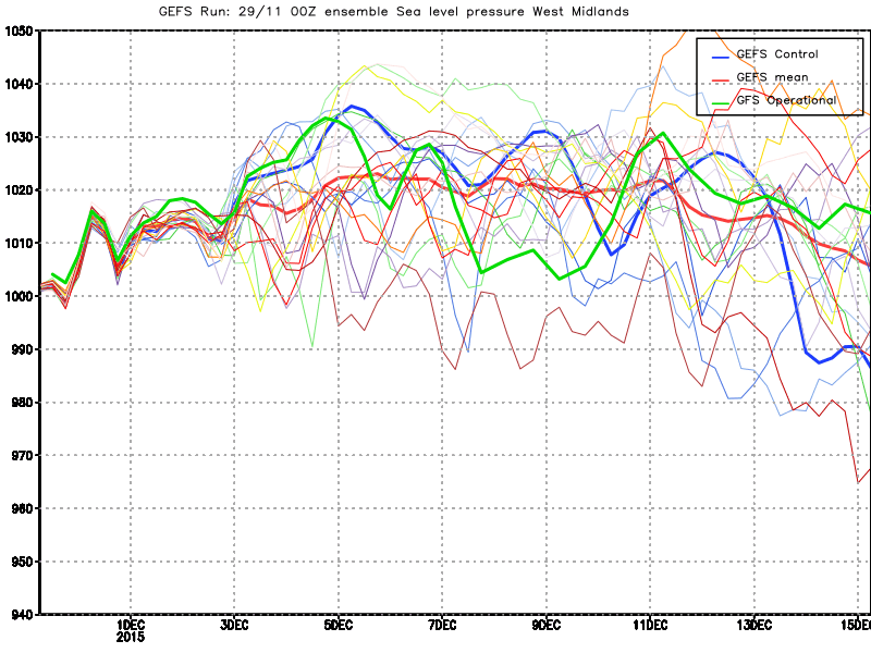
Boxing Day (Saturday) a long way off but the majority of model output go for mild even very mild conditions again, although a few do keep temperatures nearer average. Pressure likely to be on the rise next weekend with high pressure over the near Continent so it should be mostly dry if rather overcast, however possibly with occasional drizzle coming into WW. Next Sunday a bit of a guessing game, but very mild southerlies are favoured so it could be quite pleasant if breezy, provided the drizzle holds off. Maxima next weekend expected to be in the 10 to 13c range.
Largely fantastical conjecture in the lead up to New Year but reasonably high pressure seems indicated in the approach to New Year as an anticyclone to our east attempts to block the progression of Atlantic fronts. For Monday 28th to New Years Day (Friday) the Midlands may continue to see only quite small amounts of rain and with some of these days being mostly dry if rather cloudy, for WW however fronts are likely affect the weather from time to time with some spells of rain, and should the fronts get stuck, as is likely given this scenario, then some days could turn out wet here. We are likely to be seeing out 2015 with a predominance of mild weather with frost very limited or absent, just hints we may get down to more average levels come NYD.


With no sign whatsoever of a cold snap December 2015 is virtually assured of entering the record books as the mildest ever across England and Wales. It may though end up one of the dullest on record too! Continuing unsettled as well for the rest of the year with further rain at times although we could get the odd dry day in the mix perhaps more especially in the approach to the New Year and over the Midlands. Huge contrasts in fortunes with the rain during the past week, WW having had more than its fair share again, 72mm the weeks total at Llanwnnen for example, this though not so much compared to almost 200mm at Capel Curig, but small amounts over most of the Midlands, Long Lawford with just 5.0mm has had a virtually dry week!
Saturday night was really mild again, many places not dropping below 9c although for Sunday we are in distinctly less mild and fresher air even though temperatures are still well above average. Nice to be seeing sunny intervals on Sunday, quite a rash of showers (some containing hail) over Wales with only a few surviving far into the Midlands, max this afternoon 10 to 12c and a fresh SW wind. Showers for parts of WW lasting well into the night but dry for the Midlands and a much cooler night than of late (though far from cold) as it dips to 4 to 6c inland. A dry start in most places Monday but rain soon arrives across WW this spreading to the Midlands afternoon, heavy at times, especially Wales, and accompanied by a strong to gale force SW wind. Very mild afternoon at 11 to 13c.The rain should clear by teatime for a few hours at least, this with less mild temperatures during the evening down to 6 or 7c.
Yet more fronts and their rain arrive by midnight Monday with a wet windy night for much of Wales and the North Midlands, probably only light rain over the South Midlands, and temperatures back up into double figures celsius. Cloudy with spells of rain much of Tuesday, some heavy falls again over Wales, probably very little until quite late in the day for the East Midlands though. Very mild indeed once more at 12 to 14c, the odd 15c for the Midlands which we have been accustomed too! The rain then clearing east during Tuesday evening but leaving a drape of showers for WW. Sunny intervals and a few showers Wednesday and less wind, maxima cooler and fresher at 8 to 10c. A deep low then passes close to NW Scotland Wednesday night/ Thursday bringing strong to gale force winds by Wednesday evening. Heavy rain is then possible over much of WW overnight and may extend to the Midlands by morning.
Christmas Eve sees rain and wind for a time then, precise timings impossible but it does look like clearing Wales to showers by midday, but may linger well into the afternoon over the East Midlands. Again mild air associated with this frontal system (highs around 10c) but cooler and fresher air eventually as it turns more showery. Perhaps a bit of a ridge overnight killing off the Welsh showers, with clearing skies and easing winds that could just about give a ground frost in places by dawn on the Big Day! We are actually in the coolest air of the week by this stage with temperatures down closer to average into Christmas Day so at least it may be feeling somewhat more Seasonal! Dry with sunny intervals for a time we can hope for then with temperaures in the afternoon between 7 and 9c. However the model scenarios are becoming more varied by this stage and there is a fair chance that further fronts move in during the day from the SW turning it mild again with rain in places, although perhaps this not until evening at least for the Midlands? By Christmas night it is looking very mild indeed though with some rain or drizzle about and temperatures into double figures after midnight.
Boxing Day (Saturday) a long way off but the majority of model output go for mild even very mild conditions again, although a few do keep temperatures nearer average. Pressure likely to be on the rise next weekend with high pressure over the near Continent so it should be mostly dry if rather overcast, however possibly with occasional drizzle coming into WW. Next Sunday a bit of a guessing game, but very mild southerlies are favoured so it could be quite pleasant if breezy, provided the drizzle holds off. Maxima next weekend expected to be in the 10 to 13c range.
Largely fantastical conjecture in the lead up to New Year but reasonably high pressure seems indicated in the approach to New Year as an anticyclone to our east attempts to block the progression of Atlantic fronts. For Monday 28th to New Years Day (Friday) the Midlands may continue to see only quite small amounts of rain and with some of these days being mostly dry if rather cloudy, for WW however fronts are likely affect the weather from time to time with some spells of rain, and should the fronts get stuck, as is likely given this scenario, then some days could turn out wet here. We are likely to be seeing out 2015 with a predominance of mild weather with frost very limited or absent, just hints we may get down to more average levels come NYD.


