Headline: Cool and showery to midweek then becoming drier & brighter; tentatively a fine & rather warmer Holiday weekend?
Last week's highlights
Last week's highlights
In spite of a weak cold front passing over Monday was largely dry, bright and quite warm, a few spots in the Midlands scraped 20c such as Nottingham at 20.1c, more generally though max temperatures of 15 to 18c Monday. Tuesday mostly dry too with sunny spells, but temperatures back down close to average or slightly below, Pershore warmest at max 17.5c. A touch of ground frost in places on Tuesday night, coldest spots down around 2c in the air. Wednesday for most saw around average maxima but some areas were quite warm with sunny spells with most of West Wales (WW) having a nice sunny day. Llanwnnen had its warmest day of May to date, max 19.3c, this a fair bit higher though than the warmest official weather station across our regions, namely Pershore and Hereford at max 17.5c, with coastal areas of Wales, although sunny, affected by sea breezes pegging temperatures down below 16c (Aberporth just 13.0c).
While the UK struggles to find much in the way of warm weather this month, Iberia (Spain and Portugal) in contrast saw record May heat last week as 40c was exceeded on several days. Cordoba, Spain had a maximum temperature of 41.2c on Wednesday breaking the European record for heat in May. This record lasted just 24 hours as on Thursday Xativa reached a staggering 42.9c (109f) and 30c hotter than most of Wales and the Midlands! Thursday's low ended up a southerly tracking one, the centre crossing the tip of Cornwall, with the worst of the wet weather over South Wales and the South Midlands, wettest being Pembrey Sands, 13.8mm, although some places saw very little rain, and it did not quite reach Nottingham which had a dry day. Very cool over the Midlands as well as rather wet on Thursday, many places no higher than 10c, Little Rissington (Cotswolds) only managing max 8.0c, most of WW was 12 to 14c however.
Another grass frost locally on Thursday night, lowest air temp 1.2c at Trawsgoed but Friday and Saturday were milder with decent sunny spells and mostly dry, although some areas still on the cool side for mid May, Aberporth sunniest place in the UK Saturday with 13 hours.
The week ahead
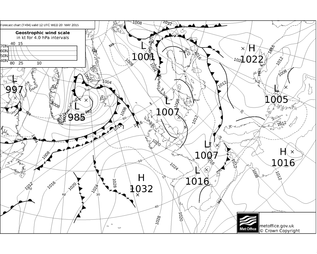
After a bright morning in places a rather cloudy and breezy Sunday afernoon to come with drizzle for some, chiefly over NW Wales, highs a rather cool 13 to 15c. A frontal system crossing southern Britain turns it rather wet everywhere after midnight, some fairly heavy rain in places, no lower than 7c. The rain may linger across the SE Midlands through Monday morning but then all areas seeing sunny intervals and showers, some heavy. A cool day, max 12 to 15c with quite a fresh WNW wind. Most showers dying overnight, chilly but too much wind for frost risk. Low pressure slow moving close to Scotland on Tuesday means another cool and showery day, more in the way of heavy showers about, hail and thunder in places, with few places escaping a downpour or two. Poor maxima Tuesday of 11 to 14c, perhaps just 10c at best over a rather wet Snowdonia, and with a fresh NW wind. Showers dying out away from windward coasts and hills overnight, down to 2c in coldest spots with a grass frost possible very locally.
High pressure still anchored to our SW is edging closer during Wednesday so that most of the showers die out over Wales but still occurring over the Midlands, some still heavy ones scattered around. Sunny intervals but still that keen NW breeze so cool once more, maxima 13 to 15c. Clear spells and cool overnight down to 3 to 5c. We could be fortunate to have a ridge over us Thursday which may be a mostly dry day with sunny spells, especially over the Midlands where it will be a warmer day, 18c in places, more like 13 to 16c elsewhere though. Clouding over perhaps afternoon as weak fronts may be arriving to bring light rain or drizzle into NW Wales and the North Midlands in particular by the end of the day.
Support in the models for reasonably strong ridging over Wales and the Midlands continuing over much of the Holiday weekend although things may break on the Monday itself. Friday though perhaps a 'fly in the ointment' weak frontal sector loitering with light rain or drizzle in places, which should eventually be drying out and even brightening. Saturday and Sunday most favourable for some fine conditions with decent sunny spells, although the odd shower cannot be ruled out entirely, especially over the Midlands, essentially though it is hopeful for a dry and bright weekend. Most models have it somewhat warmer over the weekend but by no means all, so expect maxima in the 14 to 19c range, sheltered spots could scrape a 20c, and not a bad weekend in prospect with plentiful dry weather. Just about possible that the airmass is cool enough to permit local ground frost overnights, 1c minima probably at lowest in hollows. If fortunate, this dry, fine weather may stick into Monday too, equally weather fronts could arrive with cloud and some rain during the day.


While the UK struggles to find much in the way of warm weather this month, Iberia (Spain and Portugal) in contrast saw record May heat last week as 40c was exceeded on several days. Cordoba, Spain had a maximum temperature of 41.2c on Wednesday breaking the European record for heat in May. This record lasted just 24 hours as on Thursday Xativa reached a staggering 42.9c (109f) and 30c hotter than most of Wales and the Midlands! Thursday's low ended up a southerly tracking one, the centre crossing the tip of Cornwall, with the worst of the wet weather over South Wales and the South Midlands, wettest being Pembrey Sands, 13.8mm, although some places saw very little rain, and it did not quite reach Nottingham which had a dry day. Very cool over the Midlands as well as rather wet on Thursday, many places no higher than 10c, Little Rissington (Cotswolds) only managing max 8.0c, most of WW was 12 to 14c however.
Another grass frost locally on Thursday night, lowest air temp 1.2c at Trawsgoed but Friday and Saturday were milder with decent sunny spells and mostly dry, although some areas still on the cool side for mid May, Aberporth sunniest place in the UK Saturday with 13 hours.
The week ahead
After a bright morning in places a rather cloudy and breezy Sunday afernoon to come with drizzle for some, chiefly over NW Wales, highs a rather cool 13 to 15c. A frontal system crossing southern Britain turns it rather wet everywhere after midnight, some fairly heavy rain in places, no lower than 7c. The rain may linger across the SE Midlands through Monday morning but then all areas seeing sunny intervals and showers, some heavy. A cool day, max 12 to 15c with quite a fresh WNW wind. Most showers dying overnight, chilly but too much wind for frost risk. Low pressure slow moving close to Scotland on Tuesday means another cool and showery day, more in the way of heavy showers about, hail and thunder in places, with few places escaping a downpour or two. Poor maxima Tuesday of 11 to 14c, perhaps just 10c at best over a rather wet Snowdonia, and with a fresh NW wind. Showers dying out away from windward coasts and hills overnight, down to 2c in coldest spots with a grass frost possible very locally.
High pressure still anchored to our SW is edging closer during Wednesday so that most of the showers die out over Wales but still occurring over the Midlands, some still heavy ones scattered around. Sunny intervals but still that keen NW breeze so cool once more, maxima 13 to 15c. Clear spells and cool overnight down to 3 to 5c. We could be fortunate to have a ridge over us Thursday which may be a mostly dry day with sunny spells, especially over the Midlands where it will be a warmer day, 18c in places, more like 13 to 16c elsewhere though. Clouding over perhaps afternoon as weak fronts may be arriving to bring light rain or drizzle into NW Wales and the North Midlands in particular by the end of the day.
Support in the models for reasonably strong ridging over Wales and the Midlands continuing over much of the Holiday weekend although things may break on the Monday itself. Friday though perhaps a 'fly in the ointment' weak frontal sector loitering with light rain or drizzle in places, which should eventually be drying out and even brightening. Saturday and Sunday most favourable for some fine conditions with decent sunny spells, although the odd shower cannot be ruled out entirely, especially over the Midlands, essentially though it is hopeful for a dry and bright weekend. Most models have it somewhat warmer over the weekend but by no means all, so expect maxima in the 14 to 19c range, sheltered spots could scrape a 20c, and not a bad weekend in prospect with plentiful dry weather. Just about possible that the airmass is cool enough to permit local ground frost overnights, 1c minima probably at lowest in hollows. If fortunate, this dry, fine weather may stick into Monday too, equally weather fronts could arrive with cloud and some rain during the day.


No comments:
Post a Comment